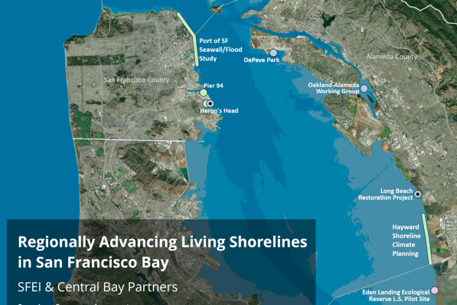
Regionally Advancing Living Shorelines in San Francisco Bay Project

Alameda and Contra Costa Counties, Measure AA Region: East Bay; San Francisco County, Measure AA Region West Bay; and Marin County, Measure AA Region North Bay.
Monitoring of existing living shorelines pilot projects, preparation of guidance for a programmatic permit approach, and a framework for collaboration.
Vital Fish, Bird and Wildlife Habitat Program, Integrated Flood Protection Program
2023 UPDATE: The San Francisco Estuary Institute and the State Coastal Conservancy have been implementing activities with contractors, including monitoring at existing living shoreline pilot sites, planning for a programmatic permit framework for 10 future new living shorelines sites, and planning for establishment of a living shorelines collaborative to share information and get input from local partners and community groups. Three additional grants were secured for the overall project which includes development of Regional Design and Constructability Guidance for Living Shorelines, and preparation of 10 new site designs to 65% and permit applications. The three additional grants are from National Fish and Wildlife Foundation, EPA SF Bay Water Quality Improvement Fund, and the Coastal Conservancy.
***
The Regionally Advancing Living Shorelines Project in San Francisco Bay is a planning project to prepare the designs, environmental review documentation, and permits needed for 10 new living shoreline climate adaptation projects. A goal of the project is to plan and permit the 10 projects in a collaborative, programmatic manner to increase efficiency and serve as a model for other living shorelines projects.
The Authority grant funds three of the project’s components: monitoring of existing living shorelines pilot projects (which will inform design of future projects), preparation of guidance for a programmatic permit approach, and a framework for collaboration.
The locations of the 10 living shoreline climate adaptation projects are in three heavily urbanized reaches of the Central Bay shoreline (San Francisco, Sausalito to San Rafael, and Hayward to Albany) and include a mix of both highly modified areas of anthropogenic fill and natural shoreline conditions including tidal marshes and mudflats, coarse grain sand and gravel beaches, and rocky intertidal areas that extend down into the submerged nearshore aquatic habitats, which include shellfish, eelgrass, seaweed, and sand beds and other important fish and wildlife habitats. These shorelines are adjacent to underserved frontline communities that are currently impacted by coastal erosion, flooding, and storm events, and at high future risk from more severe flooding, sea level rise (SLR), and other coastal hazards.
With increasing urgency to adapt to climate changes and sea level rise there is a need to rapidly expand capacity, scale-up efforts, and engage a wider network of community partners, municipalities, public and private landowners, and scientific and engineering partners. This capacity-building is critically needed in order to scale up from a limited research stage and integrate and normalize these nature-based restoration approaches within traditional shoreline master planning, sea level rise adaptation planning, and ongoing shoreline management by city, county, state, and private landowners.
